Submit a trip report
Warner River
Monday May 5th, 2008Organizer: Dave Packie
Predominantly: intermediate WW
Water Level: medium low
Author: Dave Packe
Painted Gauge (ft): 2.60
Estimated cfs: 700
River Gauge (loc): Under the first bridge
Internet Gauge (cfs): 750
USGS Gauge Name: Warner river
Kayakers (K1): Paul Savard, Ryan Mcall, Dave Packie
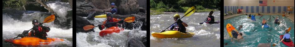
Headed over to the Warner River, Just outside of Warner NH for a sunday afternoon paddle. It hold water really well, and most tings around here were low. I had fond memories of this river, but hadn't run it for a coupla years. I remembered it being about an hour from Montpelier....it ended up being closer to 2. I remembered the run being a 4....it's more of a 3. I remembered the run being long and busy. It's short....but it did have some fun stuff on it. It's a pretty little stream that would be a nice warm up for some of the harder runs in the area. There were no mishaps and we got 2 laps in, on the last lap we ran down to the final rapid that was a fun breeched dam.....about 4 miles downstream from the last significant White Water.....it was alot of flat water, but good company. The run of choice would be From Melvin Mills road down to the first take out, on a dirt road where the flat water obviously starts, prolly a mile and a half. It would be a great first creek for someone, and is close to the Sugar which is a step easier.