Visit the USGS National Water Dashboard
In the modern era, the amazing/incredible public servants at the USGS inform (and in our case sometimes titillate) the public on the National Water Dashboard. Spend time getting to know the dashboard - truly the most comprehensive, one-stop-shop for assessing the state of realtime water:
- in the rivers
- on the ground (as rain OR snow), and
- falling from the sky (animated doppler radar).
Here you will also find detailed forecasts for rain and snow in the hours/days ahead.
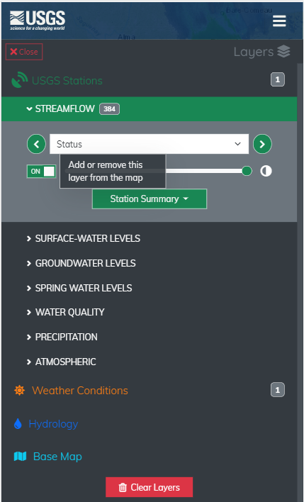
On your phone, laptop, or desktop get familiar with the dashboard's many Layers and its Legend, and use them to get a comprehensive hydrologic/meteorologic picture. For example, not all of the 380+ stream monitoring facilities in NY/New England have rainfall data available. To see only those stations, toggle off the streamflow layer and toggle on the precipitation layer.
Then, share what you learned and find folks looking to paddle using the VPC Community Forum or the VPC 3-hour ChatBot (bottom left corner on each page of the VPC website).
Visit (in a new tab/window):
USGS NATIONAL WATER DASHBOARD

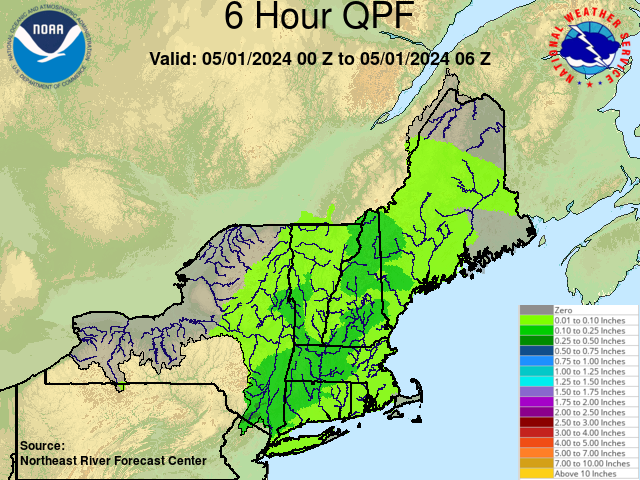
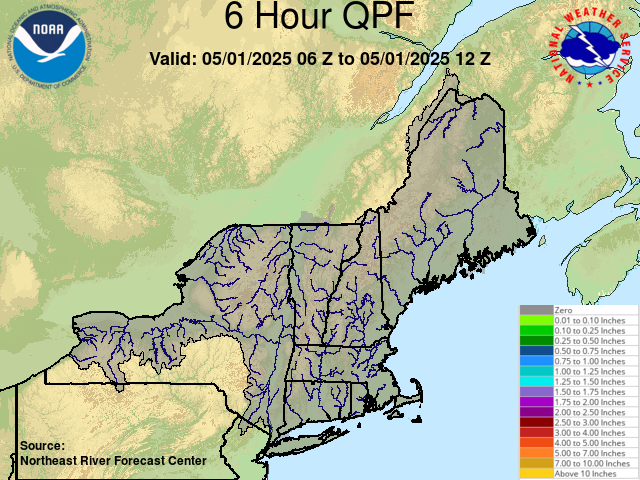
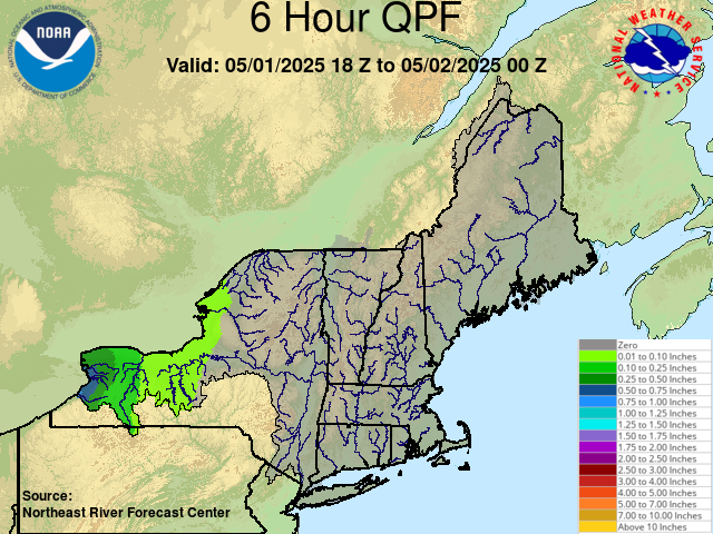
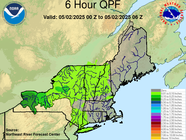
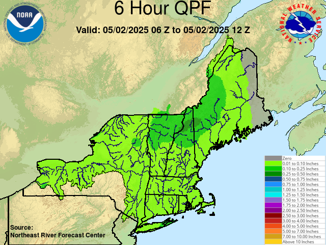
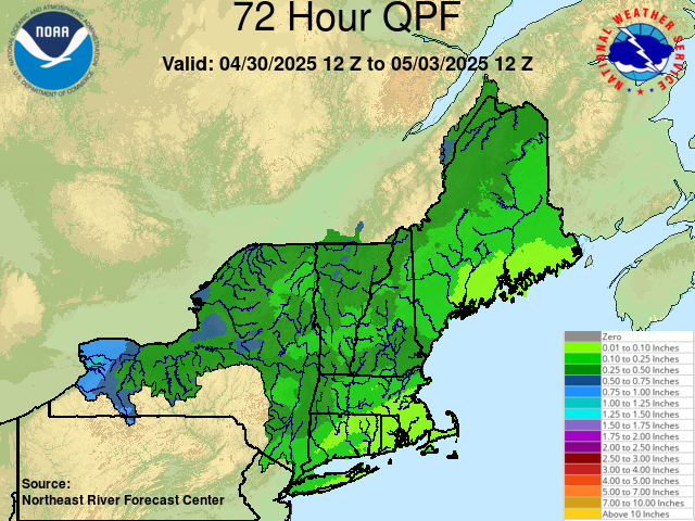
In each 6 hour window (over the next 30 hours) the NWS/NRFC expects...
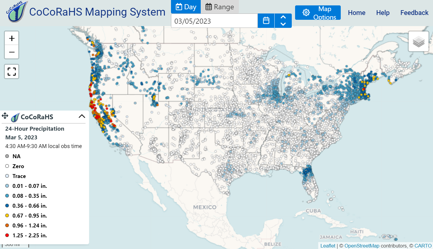
Visit CoCoRaHS 24-hour Precipitation
CoCoRaHS is an acronym for the Community Collaborative Rain, Hail and Snow Network.
In 1998 a small but ever-growing army of CoCoRaHS volunteers from Hawaiʻi to NY/New England (and beyond) started logging on each morning by 7 or 8am to report their rain/snow gauge totals for the past 24 hours, then empty out their 4" diameter rain/snow gauge (available here) to start the collection over.
This free, crowd-sourced online treasure trove of data may give the clearest picture of the moist manna from heaven in your locale over the past day or two (or three).
To become a CoCoRaHS observer all you need is:
- Internet access
- One of these 4" rain gauges
- Your lat/lng coordinates, e.g. 40.5993, -105.1152
- A parent or guardian (if under 18)
- A willingness to empty your gauge ~daily and report your results
Print some color CoCoRaHS flyers to spread the word on the streets or in the office.
Visit:
CoCoRaHS 24-hour Precipitation
Nerd out with this 4 minute animated video history of CoCoRaHS and its founder, Nolan Doesken.
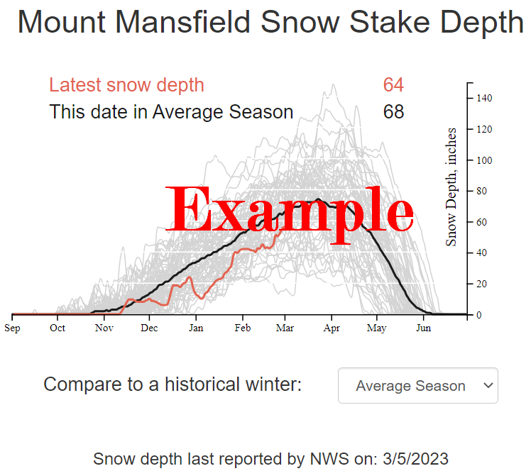
Visit the Mount Mansfield Snow Station
Snow at the stake atop Vermont's highest peak (Mt. Mansfield, el. 4393') is a bellwether for winter/spring skiing and whitewater paddling conditions in our state. Here Matt Parrilla charts current vs. historical snow depth on high and incorporates NOAA's graphical 72-hour snowfall prediction as well as the NWS 7-day text weather forecast.
NB: Most year's by ~April 15th the snowpack over the majority of the state has dwindled to nearly nothing, but "April showers..." can extend our whitewater creeking season well into May (or beyond).
Visit the:
Mount Mansfield Snow Station